 GlobeVerge
WORLD
GlobeVerge
WORLD
Satellite images show bedrock and glacier collapsed on Nepal-China border, then rivers flooded
CNA
9h ago
5 newsrooms in 2 countries
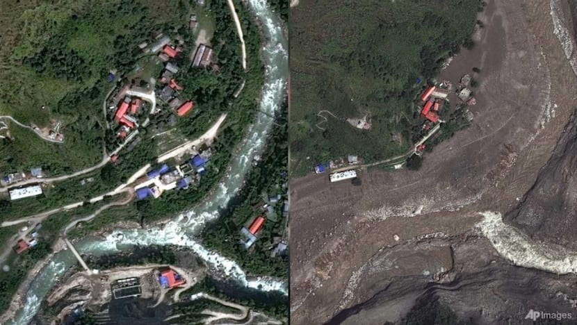
Satellite images before and after the disaster show where people were living and how the debris had buried villages.
Read more on CNA